Department of the Army SCOPING DOCUMENT
|
|
|
- Raymond Leslie Lynch
- 6 years ago
- Views:
Transcription


1 Department of the Army SCOPING DOCUMENT Northwest Aviation Operations Off-base Helicopter Training Areas September 2015
2 ii This page intentionally left blank.
3 TABLE OF CONTENTS 1.0 INTRODUCTION SCOPING Purpose of Scoping Scoping Comments PURPOSE AND NEED FOR THE ACTION Purpose of the Proposed Action High Altitude Training Operations Low Level Training Operations Need for the Proposed Action High Altitude Training Operations Low Level Training Operations Scope of Analysis Existing Off-Base Military Airspace Public Airports Relationship to Statutes, Regulations, and Policies PROPOSED ALTERNATIVES to BE CONSIDERED Alternative 1: No-Action Alternative Alternative 2: Three HTAs and One MTA (Agency Proposed Preferred Alternative) Low Level Training Operations Mountain Training Area Helicopter Landing Zones Use of Training Areas by Other than JBLM Military Units Best Management Practices (BMP) and Mitigation Fly Friendly Program Alternatives Considered but Eliminated from Further Consideration Established High-Altitude Training Sites Alternative Sites for Helicopter Training RESOURCES PROPOSED FOR ANALYSIS EA PREPARATION SCHEDULE LIST OF FIGURES Figure 1-1. General Location Map of Proposed Training Areas... 1 Figure 4-1. Proposed MTA Figure 4-2. Proposed HTAs Figure 4-3. General Location Map of Eliminated Sites LIST OF TABLES Table 3-1. Public Airports Within or Adjacent to Proposed Training Areas... 6 Table 4-1. Screening Criteria... 8 Table 4-2. Evaluation Criteria... 9 Table 4-3. Maximum Noise Levels of Rotary Wing Aircraft (CHPPM 2009) Table 4-4. Proposed Helicopter Landing Zones iii
4 Table 6-1. EA Milestones LIST OF APPENDICES Appendix A: Helicopter Landing Zone Photos iv
5 LIST OF ACRONYMS AGL BMP CAB CCDR CEQ CFR CONUS DoD EA EIS EO FAA FNSI FORSCOM HAMET HLZ HTA IFR JBLM MOA MTA MTR NEPA NGO NM NOA SOP VFR VMC VR YTC above ground level best management practice Combat Aviation Brigade Combatant Commander Council on Environmental Quality Code of Federal Regulations Contiguous United States Department of Defense Environmental Assessment Environmental Impact Statements Executive Order Federal Aviation Administration Finding of No Significant Impact US Army Forces Command High-Altitude Mountain Environmental Training Helicopter Landing Zone Helicopter Training Area Instrument Flight Rules Joint Base Lewis-McChord Military Operations Area Mountain Training Area Military Training Route National Environmental Policy Act Non-Governmental Organization nautical mile Notice of Availability Standing Operating Procedure Visual Flight Rules Visual-Meteorological Conditions Visual Route Yakima Training Center v
6 vi This page intentionally left blank.
 and one mountain training area (MTA) (Figure 1-1). The U.S.")
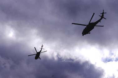
7 1.0 INTRODUCTION The Aviation Division within the Directorate of Plans, Training, Mobilization, and Security at Joint Base Lewis-McChord (JBLM) proposes to establish three off-base helicopter training areas (HTAs) and one mountain training area (MTA) (Figure 1-1). The U.S. Army is the lead Federal agency for compliance with the National Environmental Policy Act (NEPA) per compliance requirements of the Council on Environmental Quality (CEQ) regulations implementing NEPA at 40 Code of Federal Regulations (CFR) Part as well as Army NEPA implementing regulations at 32 CFR 651. The proposed training areas would support training operations stationed out of JBLM, but would be located off-base within Washington State. Training operations would be conducted using aircraft to include the MH/UH-60 Black Hawk, AH-64 Apache, and MH/CH-47 Chinook. The training areas would be available for use day and night, 24 hours a day, 365 days a year, with the exception of Federal holidays. Under NEPA regulations (40 CFR Part ) and the Army NEPA implementing regulation at 32 CFR 651, the Army must conduct an environmental impact analysis to inform decisionmakers and the public of the potential environmental consequences of proposed Army actions. The Army intends to prepare an Environmental Assessment (EA) that evaluates the potential effects of the proposed aviation operations in Washington. Figure 1-1. General Location Map of Proposed Training Areas
8 2.0 SCOPING This scoping document (SD) is intended to provide the interested parties the proposed scope of the EA and to seek additional information pertinent to this analysis. This document contains: (1) request for comments and information, (2) the purpose and need for the proposed action, (3) a description of the proposed action and alternatives, (4) schedule for the development of the EA, and (5) proposed EA outline. 2.1 Purpose of Scoping Scoping is the process used to identify issues, concerns, and opportunities for enhancement or mitigation associated with a proposed action. According to NEPA, the process should be conducted early in the planning stage of the project. The purposes of the scoping process are as follows: invite participation of federal, state and local resource agencies, Indian tribes, nongovernmental organizations (NGOs), and the public to identify significant issues related to the proposed project; determine the resource issues, depth of analysis, and significance of issues to be addressed in the EA; identify how the project would or would not contribute to cumulative effects in the project area; identify reasonable alternatives to the proposed action that should be evaluated in the EA; solicit, from participants, available information on the resources at issue; and determine the resource areas and potential issues that do not require detailed analysis during review of the project. 2.2 Scoping Comments During the scoping process, the Army requests federal, state, and local resource agencies, Indian tribes, NGOs, and the public to forward any information that would assist us in conducting an accurate and thorough analysis of the project-specific and cumulative effects associated with the proposed project. The types of information requested include, but are not limited to: information, quantitative data, or professional opinions that may help define the geographic and temporal scope of the analysis (both site-specific and cumulative effects), and that helps identify significant environmental issues; 2
9 identification of, and information from, any other EA, Environmental Impact Statement (EIS), or similar environmental study (previous, on-going, or planned) relevant to the proposed project; existing information and any data that would help to describe the past and present actions and effects of the proposed project and other developmental activities on environmental and socioeconomic resources; information that would help characterize the existing environmental conditions and habitats; the identification of any federal, state, or local resource plans, and any future project proposals in the affected resource area (e.g., military training proposals, recreation areas, timber harvest activities, or development proposals) along with any implementation schedules; documentation that the proposed project would or would not contribute to cumulative adverse or beneficial effects on any resources. Documentation can include, but need not be limited to, how the project would interact with other projects in the area and other developmental activities; study results; resource management policies; and reports from federal and state agencies, local agencies, Indian tribes, NGOs, and the public; and documentation showing why any resources should be excluded from further study or consideration. The requested information and comments on this SD may be transmitted via or standard mail. All comments must clearly identify the following on the first page: JBLM Off-base Helicopter Training Areas. You must include your name and contact information at the end of your comments. The scoping period has been extended through November 3, COMMENTS MUST BE RECEIVED BY NOVEMBER 3, Comments submitted electronically should be submitted via to: Hard copy comments should be mailed to the following address: DEPARTMENT OF THE ARMY DIRECTORATE OF PUBLIC WORKS ATTN ENVIRONMENTAL DIVISION (NEPA) 2012 LIGGETT AVE, BOX MS 17 JOINT BASE LEWIS-MCCHORD WA
10 3.0 PURPOSE AND NEED FOR THE ACTION 3.1 Purpose of the Proposed Action The purpose of the proposed action is for the Army to conduct the necessary type, level, and duration of aircraft movements through the National Airspace System, so aircrews can attain and maintain flying proficiency and be ready for immediate deployment world-wide in support of the National Defense Mission High Altitude Training Operations The proposed high altitude training area would provide JBLM aviation units with mandatory high-altitude flight operations training, while recognizing Army environmental and social stewardship responsibilities within the affected region Low Level Training Operations The proposed low-level training areas would provide JBLM aviation units with low-level training areas off JBLM to eliminate training conflicts between JBLM aviation units and other units training at JBLM. 3.2 Need for the Proposed Action The following sections identify the need for the proposed action. JBLM on-base training areas are currently limited due to a reduction in density as a result of 2011 regulation changes (JBLM Regulation 95-1, See Section 3.4 below) and scheduling conflicts with other units, particularly ground-based operations for low-level flight operations. High Altitude Mountainous Environment Training (HAMET) is currently limited to a select number of sites in the contiguous United States (CONUS) which all require extensive travel time, scheduling difficulties and cost High Altitude Training Operations It is vitally important to conduct High-Altitude Mountain Environmental Training (HAMET) in order to prepare Army aircrews. This training is critical to save the lives of aviators and the Soldiers they transport. The need for well-prepared aviation brigades to conduct combat operations in Afghanistan led the US Army Forces Command (FORSCOM) to prioritize the development of standardized training for high-altitude (up to 14,000 ft [4,267 m]) mountainous conditions. HAMET was developed to ready pilots for success in combat operations. HAMET adapts the National Guard s school for individual mountain helicopter training taught in Gypsum, Colorado. High altitudes and mountainous terrain pose several challenges to Army helicopter pilots. High altitudes are associated with high wind, high-density altitude (i.e. pressure altitude that is corrected for temperature and humidity), turbulence and atmospheric instability. These factors greatly affect the performance of a helicopter engine and the handling characteristics of an aircraft. For example, an increased density altitude decreases the effectiveness of the rotor blades in providing both overall lift and thrust power to the tail rotor for directional control (i.e. increasing density altitude increases drag ). Thus, an increased angle of attack and increased 4
11 power are required to offset the increased drag. Simultaneously, the engine is less capable of producing power in the thinner air of higher altitudes, and the higher the altitude, the greater these effects have on the aircraft. As such it is imperative that pilots master performance planning, power management, and high-altitude flight techniques to compensate for decreased aircraft performance in high-altitude, mountainous environments Low Level Training Operations Opportunities for low-level training by JBLM aviation units are limited by the available on-base airspace. JBLM aviation regulations were changed in 2011 to reduce the allowable aircraft density in the training areas (JBLM Regulation 95-1, See Section 3.4 below). In addition, lowlevel training conflicts with training activities by other units, including ground-based activities by Brigade Combat Teams, who are given priority of usage. Due to the limited airspace and the density of indirect fire weapon systems, JBLM requires dedicated off-base HTAs which would allow all assigned units and missions to meet the Aircrew Training Program requirements for Full Spectrum day and night training. Approved low-level training areas off-base would alleviate land-use conflicts that are occurring now and to allow for future growth of the crews training at JBLM. 3.3 Scope of Analysis The EA would analyze the potential environmental effects of two alternatives: the Proposed Action and a No-Action Alternative. The EA would analyze direct effects (those caused by the action and occurring at the same time and place) and indirect effects (those cause by the action and occurring later in time or farther removed in distance, but that are still reasonably foreseeable). The potential for cumulative effects (effects resulting from the incremental impact of the action when added to other past, present, and reasonably foreseeable future actions) would also be addressed, and mitigation measures to avoid, minimize, rectify, reduce, or compensate for impacts would be identified, where appropriate Existing Off-Base Military Airspace Military Operations Areas (MOAs) and off-base military training routes (MTRs) exist within the proposed training areas. A MOA is defined by the FAA as airspace designated outside of Class A airspace, to separate military activities from instrument flight rules (IFR) traffic and identify visual flight rules (VFR) traffic where these activities are conducted (FAA 2014). The purpose of a MOA is to contain military flight activities, although the airspace remains in joint use for VFR aircraft as well as IFR aircraft which may be routed through the airspace. The Okanogan MOA is located in north central Washington, bounded by the US-Canadian border to the north, 48 degrees north latitude to the south, 119 degrees west longitude to the east and 121 degrees west longitude to the west. The floor of the MOA originates at 2000 feet above ground level (AGL). A Visual Route (VR) MTR exists within one of the proposed HTAs. VR 331 originates at McChord Field Airfield for C-17 Globemaster III and C-130 Hercules aircraft. The route through the 5
12 proposed HTA is 4 nautical miles (NM) on either side of the centerline. The MTR includes terrain following operations of 300 feet AGL only in visual meteorological conditions (VMC). While the footprint of the MOA overlaps with the proposed training area, the MOA is located at an altitude that is generally higher than the proposed training would occur. The MTR usage would overlap with the proposed training. The MOA and the MTAs have been analyzed individually. The EA would only look at any cumulative impacts from the addition of the proposed training Public Airports Public airports exist within and adjacent to the proposed training areas (Table 3-1). The locations of proposed training areas were selected in part, based on proximity to JBLM due to flight time and fuel needs. Typically, training missions would be expected to be completed without the need for refueling. However, infrequent refueling or emergency landings could occur at these public airports. These airports are outside of the scope of analysis that would be included in the EA. Table 3-1. Public Airports Within or Adjacent to Proposed Training Areas Airport Name City Anderson Field Airport Brewster Bowerman Airport Hoquiam Cashmere-Dryden Airport Cashmere Chehalis-Centralia Airport Chehalis Dorothy Scott Municipal Oroville Ed Carlson Memorial Field - South Lewis Co Airport Toledo Elma Municipal Airport Elma Lake Chelan Airport Chelan Lake Wenatchee State Airport Leavenworth Lost River Resort Airport Mazama Methow Valley State Airport Winthrop Ocean Shores Municipal Airport Ocean Shores Okanogan Legion Airport Okanogan Omak Airport Omak Pangborn Memorial Airport Wenatchee Port of Ilwaco Ilwaco Southwest Washington Regional Airport Kelso Tonasket Municipal Airport Tonasket Twisp Municipal Airport Twisp Waterville Airport Waterville Westport Airport Westport Willapa Harbor Airport Raymond 6
13 3.4 Relationship to Statutes, Regulations, and Policies The intent of the EA is to comply with NEPA by assessing the potential impacts of off-base aviation operations on resources in Washington State. Additional guidance for NEPA compliance and for assessing impacts is provided in the CEQ Regulations for Implementing the Procedural Provisions of NEPA (40 CFR Parts ), and Environmental Effects of Army Actions (32 CFR Part 651). Army decisions that affect environmental resources and conditions also occur within the framework of numerous laws, regulations and Executive Orders (EOs). Some of these authorities prescribe standards for compliance; others require specified planning and management actions, the use of which is designed to protect environmental values potentially affected by proposed training operations. Laws and related regulations bearing on the proposed Army actions include, but are not limited to, the Clean Air Act; Clean Water Act; Coastal Zone Management Act; Endangered Species Act; Migratory Bird Treaty Act; Marine Mammal Protection Act; National Historic Preservation Act; Noise Control Act; and Pollution Prevention Act. EOs bearing on proposed Army actions include EO (Protection of Wetlands), EO (Federal Actions to Address Environmental Justice in Minority Populations and Low-Income Populations), EO (Sacred Indian Sites), EO (Protection of Children from Environmental Health Risks and Safety Risks), and EO (Responsibilities of Federal Agencies to Protect Migratory Birds). Army actions are also governed by DOD, Army and JBLM regulations, including the following: Army Regulation (Environmental Quality Environmental Protection and Enhancement; December 13, 2007) JBLM Regulation (Environmental Protection and Enhancement; November 1, 2004) Army Regulation (Army Safety Program; August 23, 2007); Department of the Army Pamphlet (Army Aviation Accident Prevention Program; August 28, 2007) JBLM Regulation 95-1 (Aviation Flight Regulations; December 18, 2012) Army Regulation 95-1 (Flight Regulations; November 12, 2008) Fort Lewis Regulation (Fort Lewis Range Regulations; March 29, 2000; Change 1 November 23, 2005) Fort Lewis Regulation (Army Public Affairs Fort Lewis Noise and Vibration Complaint Procedure; March 13, 1998) Fort Lewis Regulation (Procedures for the Protection of State and Federally Listed Threatened, Endangered, Candidate Species, Species of Concern, and Designated Critical Habitat; August 9, 2004) 7
14 JBLM Regulation 95-1 prescribes the procedures used by aircrews to execute flying operations. The document states crew requirements and responsibilities, the management of air and land space (aviation training areas, corridors, and routes) and flight restrictions. It provides the structure for aviation operations at JBLM in order to provide safe and efficient operations and maximize the utility of the space available for training. The regulation is required to be reviewed, and if required, updated annually to ensure it accurately addresses the requirements of local Commanders, Federal Regulations, and technology. The proponent for the regulation is the JBLM Aviation Division Chief as approved by the Joint Base Commander. Following completion of the environmental analysis and public review process, the regulation would be revised to reflect the selected alternative. 4.0 PROPOSED ALTERNATIVES TO BE CONSIDERED Alternatives considered under NEPA must include the proposed action (Proposed Preferred Alternative), and the No-Action alternative. The No Action alternative is included as a means of comparison to the action alternative to help distinguish the relative merits and disadvantages between alternatives. In order for any alternative to be acceptable for consideration it must meet the purpose and need for action. Pursuant to Army Regulation 32 CFR 651, Environmental Analysis of Army Actions, the selected alternative must meet the project purpose and need and it should be environmentally acceptable, to the extent possible. The Army used detailed initial screening and evaluation criteria to select the proposed training areas. Initial site identification included map based analysis followed by ground-truth site visits. Screening criteria (Table 4-1) was used to identify a list of preliminary HTAs and MTAs. Four HTAs and three MTAs were identified that met the screening criteria thresholds. Training area size was identified as the primary criterion based on the size requirements for specific mission essential tasks. Mission Essential Task List (METL) area requirements include but are not limited to a 3 km radius for landing area reconnaissance, a 5 km radius for evasive maneuvers, and a 10 km radius for firing techniques (includes simulation of target acquisition and instrumentation prior to firing), team employment, close combat attack and combat maneuvering flight. Evaluation criteria (Table 4-2) were used to refine the polygons for each of the proposed training areas. Table 4-1. Screening Criteria Size of Proposed HTA Distance from JBLM Environmental Feasibility Land Availability Presence of Suitable Terrain Terrain to Facilitate HLZ Operations Kilometer (KM) routes in each HTA 20 minutes flight time from JBLM Least amount of threatened/endangered species or habitat preferred State or Federally owned land preferred Valley, ridge, hill, spur, and draw preferred Open area less than 15 degrees of slope sized for H-60/H-64 (H-47 preferred) 8
15 Table 4-2. Evaluation Criteria Terrain Relief within HTA Boundaries Number of Land Owners Density of Livestock Airspace Analysis Flight Hazards Number of Developed Areas within HTA Boundaries Higher amount of terrain features preferred Fewer is preferred Lower density is preferred Fewer public airports preferred Fewer towers and logging operations preferred Fewer is preferred 4.1 Alternative 1: No-Action Alternative Analysis of the No-Action Alternative is required by the CEQ (40 CFR Part ) and Army NEPA-implementing regulations (32 CFR 651). The No-Action Alternative serves as the baseline condition for analysis of other alternatives. Under the No-Action Alternative, JBLM aviation units would not conduct off-base high-altitude training or low-level training operations in Washington. Training activities by JBLM aviation units would be limited to JBLM property and JBLM-Yakima Training Center (YTC). Based on distance from JBLM, YTC is not close enough to allow it to be a reasonable primary training area. The fastest en route time for a UH-60 (Black Hawk) is 65 minutes and 130 minutes round trip. Inclement weather restricts the number of days aircraft can travel to YTC. No local high-altitude training would occur as there are no on-base training areas at JBLM which meet the elevation criteria. Aircrews would continue to be shipped to Colorado for short training periods. These trips are expensive and can often be unavailable as Colorado provides one of the few available HAMET training sites in the U.S. and is in high demand. Low-level training would continue to conflict with training activities by other units, including groundbased activities by Brigade Combat Teams, who are given priority of usage. Therefore, the No- Action Alternative does not meet the purpose and need for the proposed action. 4.2 Alternative 2: Three HTAs and One MTA (Agency Proposed Preferred Alternative) Under the Proposed Action, the Army would publish three new HTAs west and southwest of JBLM (Figure 4-1) and establish a new MTA northeast of JBLM (Figure 4-2). These areas and the associated training activities are described in detail below (Sections and 4.2.2). The HTAs and the MTA would be located in Washington, mostly within state and federal lands. The areas would be irregularly-shaped polygons. Aircraft traveling to and from the proposed training areas would not follow a set flight path. Flight paths to each training area could vary depending on weather and other factors. Aircraft would fly to and from the proposed training areas at elevations of 500 feet AGL and higher, avoiding bad weather and populated areas and following Federal Aviation Administration (FAA) regulations for helicopters. Under the Fly Friendly Program, pilots flying to and from military training areas maintain this minimum elevation and avoid anything on the landscape that might produce any sort of a noise complaint. Therefore, 9
16 during friendly flying, populated areas and other noise-sensitive receptors would be avoided. Table 4-3 provides maximum noise levels at specified distances for the aircraft utilized in the training areas. Table 4-3. Maximum Noise Levels of Rotary Wing Aircraft (CHPPM 2009). Distance (feet) Maximum Level, dba AH-64 MH/CH-47 MH/UH , , , , The HTAs and the MTA, including the proposed landing zones within these areas, would be available for use day and night, 24 hours a day, 365 days a year, with the exception of Federal holidays. Use of the HTAs, MTA, and landing zones would occur throughout the year, as weather permits. The majority of training would occur at night. As a result, mitigation of flight activity is required to protect populated areas. The existing communication infrastructure, including radio towers within the HTAs and MTA would be sufficient to support the proposed training. No new communication infrastructure is proposed Low Level Training Operations Within the proposed training areas, helicopters would perform various mission-essential tasks that involve flying at low altitudes, from the ground surface to a height of 500 feet above treetop level. Tasks could include following the contours of the earth as low as 25 feet above the highest obstacle, formation flight, confined area approaches, hovering, low-level navigation, and other flight maneuvering of helicopters. Pilots would also land at established HLZs to practice tasks such as confined area landings. One HLZ is proposed for HTA 2. No HLZs are proposed for HTAs 3 or 4. The training activities would be used to simulate mission activities. However, no refueling, expending of live ordnance, or actual movement of troops and/or equipment between the helicopter and the ground would occur Mountain Training Area Within the proposed MTA, helicopters would perform various mission-essential tasks that involve performance planning, power management, and high-altitude flight techniques used to compensate for the decreased aircraft performance at high altitude. Pilots would fly at high altitudes and land at designated high-altitude HLZs using varying angles of approach, headings, 10
17 air speeds, under both day and night conditions (using infrared lights), to reach proficiency for the following tasks: VMC takeoff. VMC approach (typically 10 degrees) to a landing or to a 3-ft hover. Abort and go-around procedures climb-out maneuvers performed when conditions are no longer suitable for landing. A go-around procedure is a planned diversion around an HLZ; for instance, it could be performed for weather-related reasons. An abort procedure is an unplanned diversion around a HLZ. Elevated ( ft [ m]) reconnaissance over high-altitude HLZs. Slope operations landing operations performed on an angled, uneven surface. Pinnacle or ridgeline operations landing operations performed on a pinnacle, or a formation similar to a pinnacle, that is a high point on a hill (or HLZ) Helicopter Landing Zones HLZs were chosen for their training-appropriate characteristics (i.e. high-altitude mountainous terrain, uneven surfaces, and pinnacle/pinnacle-like and ridge/ridge-like features) but also with safety as a consideration so as to not harm pilots or damage aircraft. Generally, a HLZ is an area that can accommodate the landing of one or more helicopter simultaneously. The terrain condition, slope, and overall topography of the HLZ are taken into consideration when selecting a HLZ. Sites chosen for HLZs must have soil conditions that are capable of supporting the weight of the aircraft to prevent aircraft from being mired, creating excessive dust, or blowing snow. Loose material can cause obscured visual conditions. There is one proposed HLZ in HTA 2 and seven proposed HLZs in the MTA (Table 4-4). The proposed HLZs are relatively open areas that have been identified by the aviation units on JBLM as suitable for their training needs. They include abandoned quarry locations, rocky peaks, roads, and other open areas. The proposed HLZs vary in size, ranging from approximately 1 acre to 6.5 acres (Table 4-4). It is estimated that 10 to 20 landings would occur during each training session. Landings would take place at one or more of eight identified HLZs. See Appendix A for HLZ aerial maps. Pilots would land helicopters and then take off again with little delay on the HLZ. In some cases, only a portion of the helicopter, such as one wheel, would touch down on the ground. No actual movement of troops and/or equipment between the helicopter and the ground would occur. All of the identified HLZs are presently cleared of vegetation and it is assumed that they would not require any alterations or ongoing maintenance to allow them to continue to be usable for training purposes. Each training period would be approximately 4 hours in duration, and would involve no more than seven helicopters (any combination of MH/CH-47 Chinooks, MH/UH-60 Blackhawks, and AH-64 Apaches). 11
18 Table 4-4. Proposed Helicopter Landing Zones Landing Zone Location Elevation (feet) Latitude/ Longitude HTA 2-1 N W MTA 1-1 N W MTA 1-2 N W MTA 1-3 N W MTA 1-4 N W MTA 1-5 N W MTA 1-6 N W MTA 1-7 N W Size (Acres) Use 784 ft 3.5 Multi-aircraft landing zone 7186 ft 4.9 HAMET pinnacle landing zone 6307 ft 2.2 HAMET ridgeline landing zone 5753 ft 4.7 HAMET multi-aircraft landing zone 7676 ft 3.6 HAMET pinnacle landing zone 7958 ft 6.5 HAMET multi-aircraft landing zone 7420 ft 2.8 HAMET ridgeline landing zone 6934 ft 1.0 HAMET confined area landing zone Use of Training Areas by Other than JBLM Military Units The Army s Proposed Action involves use of the identified HTAs and MTA, day and night, 24 hours a day, 365 days a year, with the exception of Federal holidays. It is expected that the JBLM assigned aviation units would, for the most part, use these training areas exclusively. However, it is conceivable that other military units could request to use them for training. The Aviation Division within the Directorate of Plans, Training, Mobilization, and Security of JBLM would be the scheduling unit for the HTAs and the MTA, and is the only agency that could approve use of the training areas by other units, provided the annual training frequencies are not exceeded. The Best Management Practices (BMPs) and mitigation measures listed in the EA would apply to training activities by all military units using the training areas. Use of the training areas for the annual frequencies provided for this proposed action would require further assessment of impacts to resources and associated NEPA documentation. However, because establishing the training areas could eventually result in their use by other units in the future, it would be included in the EA analysis, particularly in regards to cumulative effects. 12

19 Figure 4-1. Proposed MTA 13

20 Figure 4-2. Proposed HTAs 4.3 Best Management Practices (BMP) and Mitigation The Army would propose mitigation for adverse effects to the natural environment under the proposed action. Mitigation strategies generally would include the following: Avoid the impact altogether by stopping or modifying the proposed action. Minimize the impacts by limiting the degree of magnitude of the action and its implementation. Rectify the impact by repairing, rehabilitating, or restoring the affected environment. Reduce or eliminate the impact over time through use of preservation and maintenance operations during the life of the action. Compensate for the impact by replacing resources or providing substitute resources. Mitigation proposed by the Army would include Standing Operating Procedures (SOPs) and BMPs that minimize risks and potential impacts of Army actions. Many SOPs are incorporated into JBLM or Army regulations. Additional BMPs would be identified during the course of developing the proposed action to help reduce or avoid anticipated potential effects to 14
21 resources from the action. These BMPs would be considered to be part of the proposed action. Other mitigation would be identified during the course of preparing the EA. In some cases, mitigation must be implemented to reduce impacts to less-than-significant levels, and would be identified as such. Specific BMPs include: The training areas would be for aviation aircrews only and not used in conjunction with ground-maneuver training activities or for picking up/dropping off troops or supplies. At no time would any aircraft involved carry ammunition. No physical modifications (such as vegetation removal or tree clearing) of the proposed HLZs would be made. Per JBLM (95-1) typical flight restrictions over eagle nests include a no-fly area from the ground to 1200 feet above ground level within 1300 feet of nesting sites from 1 December to 31 August. To prevent accidents, Army aviators would follow the procedures outlined in Army Regulation Army Aviation Accident Prevention. Where feasible, pilots would follow guidance in FAA Advisory Circular 91-36D, which recommends that pilots maintain a minimum altitude of 2,000 feet (610 meters) AGL when flying over noise sensitive areas, such as National Parks, National Wildlife Refuges, Wilderness Areas, and other areas where a quiet setting is a generally recognized feature or attribute of the land. Per the Fly Friendly Program, when conditions allow, aircraft would fly no lower than 500 feet above ground level and avoid noise-sensitive areas such as Indian Reservations, parks and wilderness areas, residential areas, schools, hospitals and built up areas. One pilot would stay focused outside the aircraft when in flight to help avoid bird strikes Fly Friendly Program The Fly Friendly Program is the equivalent to the Fly Neighborly Program, both terms are used interchangeably within DoD and Army flight guidelines. The Fly Friendly Program requires that, when conditions allow, aircraft fly no lower than 500 feet AGL and avoid noise-sensitive areas such as Indian Reservations, parks, wilderness areas, residential areas, schools and hospitals. When these areas cannot be avoided, it is recommended that pilots fly 2,000 feet AGL in noisesensitive areas to minimize noise disturbance. It is important to emphasize that rules, regulations, and other operating requirements that pertain to safety are paramount; therefore, following the Fly Friendly guidelines would not always be possible. More information on the Fly Friendly Program can be found at Although there would be no set flight paths to the HTAs or MTA, pilots would generally take the most direct route to the training areas, while avoiding noise sensitive areas such as those described above. The elevation pilots would fly to the training areas varies between 500 and 15
22 2,000+ feet AGL. This wide span in flight elevation is due to weather constraints such as cloud cover. JBLM aircraft follow visual flight rules (VFR) which require pilots to fly below the cloud level, which varies from day to day and even over the course of a single day. During the summer months, pilots can often fly at 2,000+ feet AGL, but winter weather often requires aircraft to fly at the lower thresholds ( feet AGL). 4.4 Alternatives Considered but Eliminated from Further Consideration Established High-Altitude Training Sites High-altitude training operations could be conducted at three existing locations: 1) the Army National Guard training site in Gypsum, Colorado, 2) Fort Carson in Colorado Springs, Colorado, or 3) Fort Bliss in El Paso, Texas. All three sites require extended travel times and scheduling training slots with limited availability. Any out of state training site requires additional time away from the home station, which is referred to by the military as perstempo. High perstempo can have adverse effects on soldiers and their families Alternative Sites for Helicopter Training Additional sites were identified during the initial screening process as described above in Section 4.0. Figure 4-3 shows the sites which include one MTA located just east of Mt. St. Helens and two HTAs (near Packwood/Mt. Adams and Darrington). These sites were eliminated from subsequent consideration because they failed to adequately meet several of the selection criteria. 16

23 Figure 4-3. General Location Map of Eliminated Sites 5.0 RESOURCES PROPOSED FOR ANALYSIS The following is a preliminary list of environmental issues to be addressed in the EA. These issues have been identified through analysis of past projects and ongoing military training operations. This list is not intended to be exhaustive or final, but contains those issues raised to date that could have direct, indirect or cumulative effects. After the scoping process is complete, the Army would review the list and determine the appropriate level of analysis needed to address each issue in the EA. Resources to be analyzed are as follows: Land Use Airspace Airspace Safety Noise Air Quality Cultural Resources Water Resources and Wetlands Recreation and Visual Resources Vegetation Fish and Wildlife Proposed, Threatened and Endangered Species Environmental Justice Socioeconomics 17
24 6.0 EA PREPARATION SCHEDULE The premise for NEPA is that providing information to the decision-maker and the public would improve the quality of final decisions concerning the environmental effects of federal actions. All persons who have a potential interest in the proposed action, including minority, lowincome, and Native American groups, are urged to participate in the Army s environmental impact analysis process conducted under NEPA. At this time, the Army anticipates the need to prepare a draft and final EA. The formal opportunity to comment involves a 30-day period for public review of the draft EA. The Notice of Availability (NOA) of the draft EA would be mailed electronically and/or hard copy to known stakeholders and interested parties. The NOA would also be publicized on the JBLM website and in local newspapers and libraries. The draft EA would be available for download from the JBLM website ( Within the comment period three public meetings would occur based on the wide geographic extent of the proposed action. One meeting would occur near the HTAs and two meetings would occur within the MTA. The meeting dates, times and locations would be publicized on the JBLM website and in local newspapers and libraries. The Army would review comments received during the public comment period to determine whether the proposed action has potentially significant impacts that could not be mitigated to less than significant. If impacts are found to have the potential to be significant after the application of mitigation measures, the Army would be required to publish a notice of intent to prepare an EIS in the Federal Register. If the decision-maker selects the proposed action and the EA determines that there would be no significant environmental impacts, a Finding of No Significant Impact (FNSI) would be published. The approved FNSI would be made available to the public prior to initiation of the proposed action, in accordance with 40 CFR The distribution of the FNSI would occur at least 30 days prior to initiation of the proposed action, with copies sent to any agencies, organizations, and individuals who have expressed interest in the project. A decision on whether to proceed with the proposed action also depends on permission from landowners to utilize the proposed training areas and helicopter landing zones (HLZs). The major milestones, including those for preparing the EA, are shown in Table 6-1. Table 6-1. EA Milestones Major Milestone Target Date Public Scoping Period 1 July 30 July 2015 Public Scoping Period Extension 31 July 3 November 2015 Draft EA Issued Winter 2015/2016 Public Meetings Winter 2015/2016 Comments on Draft EA Due Winter 2016 Final EA Issued Spring
25 Appendix A: Helicopter Landing Zone Photos 19

26 20

27 21

28 22

29 23

30 24

31 25

32 26

33 27
TOWNSEND BOMBING RANGE MODERNIZATION
 Frequently Asked Questions August 2011 BACKGROUND... 3 Who owns, operates, and uses Townsend Bombing Range?... 3 What is the primary purpose of TBR?... 3 Where is TBR located?... 3 When did TBR begin its
NAS North Island WELCOME. Open House Public Meeting
 NAS North Island WELCOME Open House Public Meeting for the Transition from C-2A to CMV-22B Aircraft at Naval Air Station North Island, CA and Naval Station Norfolk, VA January 18, 2018 4:00 PM to 6:00
Welcome Scoping Meeting U.S. Navy Environmental Impact Statement for the EA-18G Growler Airfield Operations at Naval Air Station (NAS) Whidbey Island
 Whidbey Island") Welcome Scoping Meeting U.S. Navy Environmental Impact Statement for the EA-18G Growler Airfield Operations at Naval Air Station (NAS) Whidbey Island Open House Public Scoping Meetings 4:00 pm to 8:00
Welcome Scoping Meeting U.S. Navy Environmental Impact Statement for the EA-18G Growler Airfield Operations at Naval Air Station (NAS) Whidbey Island Open House Public Scoping Meetings 4:00 pm to 8:00
Stationing and Training of Increased Aviation Assets within U.S. Army Alaska Environmental Impact Statement
 Final Stationing and Training of Increased Aviation Assets within U.S. Army Alaska Environmental Impact Statement Prepared for U.S. Army Alaska August 2009 How to Read This Environmental Impact Statement
GENERAL ASSEMBLY OF NORTH CAROLINA SESSION 2013 SESSION LAW HOUSE BILL 484
 GENERAL ASSEMBLY OF NORTH CAROLINA SESSION 2013 SESSION LAW 2013-51 HOUSE BILL 484 AN ACT TO ESTABLISH A PERMITTING PROGRAM FOR THE SITING AND OPERATION OF WIND ENERGY FACILITIES. The General Assembly
Department of Defense INSTRUCTION
 Department of Defense INSTRUCTION NUMBER 4715.9 May 3, 1996 USD(A&T) SUBJECT: Environmental Planning and Analysis References: (a) DoD Directive 4715.1, Environmental Security, February 24, 1996 (b) DoD
Proposal for Land Acquisition and Airspace Establishment in Support of Large-Scale MAGTF Live Fire and Maneuver Training
 Proposal for Land Acquisition and Airspace Establishment in Support of Large-Scale MAGTF Live Fire and Maneuver Training Public Information Brief June, 2015 Marine Air Ground Task Force Training Command/
Proposal for Land Acquisition and Airspace Establishment in Support of Large-Scale MAGTF Live Fire and Maneuver Training
 Proposal for Land Acquisition and Airspace Establishment in Support of Large-Scale MAGTF Live Fire and Maneuver Training Public Information Brief February 14, 2013 Marine Air Ground Task Force Training
4.6 NOISE Impact Methodology Factors Considered for Impact Analysis. 4.6 Noise
 4.6 NOISE 4.6.1 Impact Methodology Noise impacts associated with project alternatives have been evaluated using available noise data for various weapons types, available monitoring data for actual live
Public Notice U.S. ARMY CORPS OF ENGINEERS, GALVESTON DISTRICT AND TEXAS COMMISSION ON ENVIRONMENTAL QUALITY
 Public Notice U.S. Army Corps Permit Application No: SWG-2012-00381 Of Engineers Date Issued: April 27, 2016 Galveston District Comments Due: May 30, 2017 U.S. ARMY CORPS OF ENGINEERS, GALVESTON DISTRICT
EXECUTIVE SUMMARY. Florida; (3) Elmendorf AFB, Alaska; (4) Mountain Home AFB, Idaho; (5) Tyndall AFB, Florida; and (6) Nellis AFB, Nevada.
 Elmendorf AFB, Alaska; (4) Mountain Home AFB, Idaho; (5) Tyndall AFB, Florida; and (6) Nellis AFB, Nevada.") EXECUTIVE SUMMARY This Draft Environmental Impact Statement (EIS) analyzes the Air Force proposal to locate or beddown 72 operational F-22 aircraft at an existing Air Force base. The United States Congress
EXECUTIVE SUMMARY This Draft Environmental Impact Statement (EIS) analyzes the Air Force proposal to locate or beddown 72 operational F-22 aircraft at an existing Air Force base. The United States Congress
29Palms Training Land/Airspace Acquisition Project Project Description Paper Number 9
 Proposed Land Acquisition/Airspace Establishment in Support of Large-Scale MAGTF Live-Fire and Maneuver Training Project Description Paper Issue 9 July 2015 Marine Air Ground Task Force Training Command
Record of Decision for the Stationing and Training of Increased Aviation Assets within U.S. Army Alaska
 Record of Decision for the Stationing and Training of Increased Aviation Assets within U.S. Army Alaska U.S. Army Alaska OCTOBER 2009 Record of Decision (ROD) for the Stationing and Training of Increased
2 Description of the Proposed Action and Alternatives
 2 Description of the Proposed Action and Alternatives 2.1 Proposed Action The DON proposes to transition the Expeditionary VAQ squadrons at NAS Whidbey Island from the EA-6B Prowler to the EA-18G Growler
Jacksonville Range Complex Final Environmental Impact Statement/ Overseas Environmental Impact Statement (EIS/OEIS) Volume 1
 Volume 1") Jacksonville Range Complex Final Environmental Impact Statement/ Overseas Environmental Impact Statement (EIS/OEIS) Volume 1 Prepared by: United States Fleet Forces March 2009 This page intentional left
Jacksonville Range Complex Final Environmental Impact Statement/ Overseas Environmental Impact Statement (EIS/OEIS) Volume 1 Prepared by: United States Fleet Forces March 2009 This page intentional left
1.0 PURPOSE AND NEED FOR THE PROPOSED ACTION
 1.0 PURPOSE AND NEED FOR THE PROPOSED ACTION 1.1 INTRODUCTION The 27 th Fighter Wing (27 FW) at Cannon Air Force Base (AFB) is an integral part of the United States Aerospace Expeditionary Force (AEF).
What is the 29 Palms Proposed Training Land Acquisition and Airspace Establishment Project? Frequently Asked Questions July 27, 2012
 FINAL ENVIRONMENTAL IMPACT STATEMENT (EIS) MADE AVAILABLE FOR PUBLIC REVIEW 1. What are the major changes between the Draft EIS and the Final EIS? An additional mitigation measure for recreation was developed
FINDING OF NO SIGNIFICANT IMPACT: CONVERSION OF 5-5 AIR DEFENSE ARTILLERY BATTALION AT JOINT BASE LEWIS-MCCHORD
 FINDING OF NO SIGNIFICANT IMPACT: CONVERSION OF 5-5 AIR DEFENSE ARTILLERY BATTALION AT JOINT BASE LEWIS-MCCHORD Pursuant to the Council on Environmental Quality (CEQ) Regulations (40 CFR [Code of Federal
Public Notice U.S. ARMY CORPS OF ENGINEERS, GALVESTON DISTRICT AND TEXAS COMMISSION ON ENVIRONMENTAL QUALITY
 Public Notice U.S. Army Corps Permit Application No: SWG-2015-00306 Of Engineers Date Issued: 14 January 2016 Galveston District Comments Due: 16 February 2016 U.S. ARMY CORPS OF ENGINEERS, GALVESTON DISTRICT
Executive Summary. Introduction. Purpose and Need for Action. EIS Study Area
 Executive Summary Introduction This Environmental Impact Statement (EIS) evaluates the environment effects of the U.S. Army (Army) proposal to station and train a new aviation unit in Alaska. The new unit
What is the 29 Palms Training Land Acquisition and Airspace Establishment Project Frequently Asked Questions July 2015
 NATIONAL DEFENSE AUTHORIZATION ACT FOR FISCAL YEAR 2014 (NDAA) ENACTED DECEMBER 26 2013 1. Did Congress approve a modified version of Alternative 6, the Preferred Alternative, to meet the Marine Corps
FINDING OF NO SIGNIFICANT IMPACT (FNSI) Conversion of 4ID Brigade Combat Teams at Fort Carson, Colorado
 Conversion of 4ID Brigade Combat Teams at Fort Carson, Colorado") FINDING OF NO SIGNIFICANT IMPACT (FNSI) Conversion of 4ID Brigade Combat Teams at Fort Carson, Colorado 1. Introduction In accordance with the National Environmental Policy Act of 1969 (NEPA) and its implementing
FINDING OF NO SIGNIFICANT IMPACT (FNSI) Conversion of 4ID Brigade Combat Teams at Fort Carson, Colorado 1. Introduction In accordance with the National Environmental Policy Act of 1969 (NEPA) and its implementing
Subj: COMPLIANCE WITH ENVIRONMENTAL REQUIREMENTS IN THE CONDUCT OF NAVAL EXERCISES OR TRAINING AT SEA
 MEMORANDUM FOR THE CHIEF OF NAVAL OPERATIONS COMMANDANT OF MARINE CORPS 28 December 2000 Subj: COMPLIANCE WITH ENVIRONMENTAL REQUIREMENTS IN THE CONDUCT OF NAVAL EXERCISES OR TRAINING AT SEA Ref: (a) OPNAVINST
PUBLIC NOTICE REQUEST FOR PERMISSION TO ALTER A U.S. ARMY CORPS OF ENGINEERS PROJECT PURSUANT TO 33 U.S.C. SECTION 408
 DEPARTMENT OF THE ARMY CORPS OF ENGINEERS, NEW ORLEANS DISTRICT P.O. BOX 60267 NEW ORLEANS, LOUISIANA 70160-0267 REPLY TO ATTENTION OF Regional Planning and Environmental Division South Environmental Compliance
EXECUTIVE SUMMARY. Global Hawk Main Operating Base Beddown EA
 EXECUTIVE SUMMARY EXECUTIVE SUMMARY Global Hawk Main Operating Base Beddown EA This final Environmental Assessment (EA) describes the potential environmental consequences resulting from a U.S. Air Force
1.1 Introduction. 1.2 U.S. Army Alaska
 CHAPTER 1 Purpose and Need 1.1 Introduction The U.S. Army (Army) has prepared this Stationing and Training of Increased Aviation Assets within U.S. Army Alaska Environmental Impact Statement (Aviation
PUBLIC NOTICE. Attn: Mr. Christopher Layton 1200 Duck Road Duck, North Carolina CB&I 4038 Masonboro Loop Road Wilmington, North Carolina 28409
 US Army Corps Of Engineers Wilmington District PUBLIC NOTICE Issue Date: January 15, 2015 Comment Deadline: February 16, 2015 Corps Action ID Number: SAW-2014-02202 The Wilmington District, Corps of Engineers
Air Installations Compatible Use Zones Study. Eielson Air Force Base, Alaska
 Air Installations Compatible Use Zones Study Eielson Air Force Base, Alaska 2018 Air Installations Compatible Use Zones Program The Department of Defense s (DoD s) Air Installations Compatible Use Zones
Summary Report for Individual Task Perform a Tactical Aerial Reconnaissance and Surveillance Mission Status: Approved
 Summary Report for Individual Task 301-350-2205 Perform a Tactical Aerial Reconnaissance and Surveillance Mission Status: Approved Report Date: 19 Aug 2014 Distribution Restriction: Approved for public
DEPARTMENT OF DEFENSE. Department of the Navy
 DEPARTMENT OF DEFENSE Department of the Navy Record of Decision for Land Acquisition and Airspace Establishment To Support Large-Scale Marine Air Ground Task Force Live-Fire and Maneuver Training at the
SECTION 2.0 INSTALLATION DESCRIPTION
 SECTION 2.0 INSTALLATION DESCRIPTION This page intentionally left blank. SECTION 2. INSTALLATION DESCRIPTION Dyess Air Force Base (AFB) is located in Taylor County in north-central Texas. The installation
STATE ENVIRONMENTAL REVIEW PROCESS FOR PENNSYLVANIA WASTEWATER PROJECTS. Clean Water State Revolving Fund Program
 A STATE ENVIRONMENTAL REVIEW PROCESS FOR PENNSYLVANIA WASTEWATER PROJECTS Clean Water State Revolving Fund Program Pennsylvania Infrastructure Investment Authority & Pennsylvania Department of Environmental
PUBLIC NOTICE. Town of Ocean Isle Beach Attn: Ms. Debbie Smith, Mayor 3 West Third Street Ocean Isle Beach, North Carolina 28469
 US Army Corps Of Engineers Wilmington District PUBLIC NOTICE Issue Date: January 23, 2015 Comment Deadline: February 23, 2015 Corps Action ID Number: SAW-2011-01241 The Wilmington District, Corps of Engineers
Environmental Impact Statement/Overseas Environmental Impact Statement (EIS/OEIS) for the Northwest Training Range Complex (NWTRC). An EIS/OEIS is con
 for the Northwest Training Range Complex (NWTRC). An EIS/OEIS is con") Environmental Impact Statement/Overseas Environmental Impact Statement (EIS/OEIS) for the Northwest Training Range Complex (NWTRC). An EIS/OEIS is considered to be the appropriate document for this review
Environmental Impact Statement/Overseas Environmental Impact Statement (EIS/OEIS) for the Northwest Training Range Complex (NWTRC). An EIS/OEIS is considered to be the appropriate document for this review
Executive Summary EXECUTIVE SUMMARY
 EXECUTIVE SUMMARY ES INTRODUCTION AND BACKGROUND On October 14, 2011, the Army published a Notice of Availability (NOA) of a Draft Programmatic Environmental Impact Statement (PEIS) for the Modernization
PUBLIC NOTICE.
 US Army Corps Of Engineers Wilmington District PUBLIC NOTICE Issue Date: January 19, 2017 Comment Deadline: February 17, 2017 Corps Action ID Number: SAW-2011-01243 The Wilmington District, Corps of Engineers
SOUTHWEST LRT (METRO GREEN LINE EXTENSION)
") 10 Joint Development This chapter describes potential long-term direct and indirect and short-term (construction) direct and indirect effects that would result from the Southwest Light Rail Transit (LRT)
10 Joint Development This chapter describes potential long-term direct and indirect and short-term (construction) direct and indirect effects that would result from the Southwest Light Rail Transit (LRT)
CHAPTER 7 KAHUKU TRAINING AREA/ KAWAILOA TRAINING AREA
 CHAPTER 7 KAHUKU TRAINING AREA/ KAWAILOA TRAINING AREA 7.1 INTRODUCTION 7-1 7.2 LAND USE/RECREATION 7-6 7.3 VISUAL RESOURCES 7-24 7.4 AIRSPACE 7-30 7.5 AIR QUALITY 7-34 7.6 NOISE 7-43 7.7 TRAFFIC 7-47
PUBLIC NOTICE. Section 404 of the Clean Water Act (33 U.S.C. 1344) Section 10 of the Rivers and Harbors Act of 1899 (33 U.S.C.
 Section 10 of the Rivers and Harbors Act of 1899 (33 U.S.C.") US Army Corps Of Engineers Wilmington District PUBLIC NOTICE Issue Date: March 1, 2018 Comment Deadline: April 2, 2018 Corps Action ID Number: SAW-2011-02228 The Wilmington District, Corps of Engineers
US Army Corps Of Engineers Wilmington District PUBLIC NOTICE Issue Date: March 1, 2018 Comment Deadline: April 2, 2018 Corps Action ID Number: SAW-2011-02228 The Wilmington District, Corps of Engineers
LOCAL GOVERNMENT COMPREHENSIVE PLAN AMENDMENTS HENDRY COUNTY
 LOCAL GOVERNMENT COMPREHENSIVE PLAN AMENDMENTS HENDRY COUNTY The Council staff has reviewed proposed changes to the Hendry County Growth Management Plan (DEO 13-1ESR). A synopsis of the requirements of
CHAPTER 3 ENVIRONMENTAL EFFECTS ON OPERATIONS
 CHAPTER 3 ENVIRONMENTAL EFFECTS ON OPERATIONS Weather information is critical to aviation planning. Aviation commanders and staffs must have current weather forecasts and observations throughout the entire
PROPONENT'S GUIDE. Project Proposal Submission to a Designated Office
 PROPONENT'S GUIDE Project Proposal Submission to a Designated Office Table of Contents 3 4 5 5 5 6 6 6 6 8 8 8 9 9 9 10 10 10 10 10 10 10 11 11 11 11 11 12 12 Preface What is a Designated Office Evaluation?
5-Year Update Environmental Assessment for CV-22 Beddown
 , Florida February 2007 Report Documentation Page Form Approved OMB No. 0704-0188 Public reporting burden for the collection of information is estimated to average 1 hour per response, including the time
Guidelines. Ministry of Natural Resources and Forestry Land Stewardship and Habitat Restoration Program (LSHRP) Ontario.
 Ontario.") Ministry of Natural Resources and Forestry Land Stewardship and Habitat Restoration Program (LSHRP) 2015-2016 Guidelines Ontario.ca/lshrp Page 1 of 12 Application Deadline: Applications must be received
Ministry of Natural Resources and Forestry Land Stewardship and Habitat Restoration Program (LSHRP) 2015-2016 Guidelines Ontario.ca/lshrp Page 1 of 12 Application Deadline: Applications must be received
Description of Proposed Action and Alternatives
 Draft Final Description of Proposed Action and Alternatives for Air Force Helicopter Aerial Gunnery Training at North Dakota Army National Guard March 01 Draft Final Description of Proposed Action and
APPENDIX C MMR LAND USE REQUIREMENTS
 APPENDIX C MMR LAND USE REQUIREMENTS This page intentionally left blank Summarized below are the findings of the Range and Training Land Program, Land Use Requirement Study, Final Submittal, April 2003.
Exemptions from Environmental Law for the Department of Defense: Background and Issues for Congress
 Order Code RS22149 Updated August 17, 2007 Summary Exemptions from Environmental Law for the Department of Defense: Background and Issues for Congress David M. Bearden Specialist in Environmental Policy
LONG-RANGE SURVEILLANCE RECONNAISSANCE
 APPENDIX B LONG-RANGE SURVEILLANCE RECONNAISSANCE Surveillance is the primary mission of long-range surveillance teams. However they can conduct limited reconnaissance rnissions primarily within the human
* Airport, *, Ohio AlP Project No * Grant Offer
 u.s. Depa1ment of Transportation Federal Aviation Administration Detroit Airports District Office 11677 South Wayne Road Suite 107 Romulus, MI 48174 September 3, 2008 Dear *: * Airport, *, Ohio AlP Project
Fort Riley, Kansas. Brave, Responsible, and On Point. ONE for the Nation. An Army Community of Excellence
 Fort Riley, Kansas Brave, Responsible, and On Point One for Soldiers One for Families One for Civilians One for our Communities ONE for the Nation An Army Community of Excellence DRAFT 1 FORT RILEY, KANSAS
TOWN OF NEW TECUMSETH PROTOCOL FOR ESTABLISHING TELECOMMUNICATION FACILITIES
 TOWN OF NEW TECUMSETH PROTOCOL FOR ESTABLISHING TELECOMMUNICATION FACILITIES February 2009 Table of Contents Section Page Number 1.0 Introduction... 1 2.0 Objectives... 1 3.0 Jurisdiction... 1 4.0 Full
Scope of Services for Environmental Assessment for Projects
 Scope of Services for Environmental Assessment for Projects The Consultant shall submit a Scope and Fee for completion of all required studies, and final documentation in compliance with the National Environmental
Programmatic Environmental Assessment for Army 2020 Force Structure Realignment
 Programmatic Environmental Assessment for Army 00 Force Structure Realignment January 0 Assisted by: Potomac-Hudson Engineering, Inc. Gaithersburg, MD 0 This page intentionally left blank. Programmatic
PUBLIC NOTICE Application for Permit
 PUBLIC NOTICE Application for Permit 30-Day Notice Issue Date: April 19, 2016 Expiration Date: May 19, 2016 US Army Corps of Engineers No: NWP-2014-37/2 Oregon Department of State Lands No: 56882-RF Interested
Part III Guidelines
 Guidelines for the Application of Criteria for under Part III of Title X, Subtitle A of Public Law 111-11 1.1.1 1.1.2 U.S. Department of the Interior Bureau of Reclamation August 2012 This page left blank
UNITED STATES OF AMERICA FEDERAL ENERGY REGULATORY COMMISSION
 UNITED STATES OF AMERICA FEDERAL ENERGY REGULATORY COMMISSION Tennessee Gas Pipeline Company, L.L.C. National Fuel Gas Supply Corporation Docket No. CP14-88-000 Docket No. NOTICE OF INTENT TO PREPARE AN
Appendix K Mitigations, Best Management Practices, and Standard Operating Procedures
 Appendix K Mitigations, Best Management Practices, and Standard Operating Procedures Appendix K Mitigations, BMPs, SOPs TABLE OF CONTENTS Page APPENDIX K MITIGATIONS, BEST MANAGEMENT PRACTICES, AND STANDARD
JOINT PUBLIC NOTICE. October 1, 2018
 JOINT PUBLIC NOTICE United States Army Corps of Engineers New Orleans District Attn: Regulatory Branch 7400 Leake Ave. New Orleans, Louisiana 70118-3651 October 1, 2018 Project Manager: Sara B. Fortuna
CHAPTER 1 PURPOSE, NEED, AND SCOPE
 CHAPTER 1 PURPOSE, NEED, AND SCOPE 1.1 INTRODUCTION 1-1 1.2 BACKGROUND 1-3 1.3 PURPOSE OF THE PROPOSED ACTION 1-4 1.4 NEED FOR THE PROPOSED ACTION 1-4 1.5 SCOPE OF ANALYSIS 1-5 1.6 DECISION(S) TO BE MADE
CHAPTER 10. PATROL PREPARATION
 CHAPTER 10. PATROL PREPARATION For a patrol to succeed, all members must be well trained, briefed, and rehearsed. The patrol leader must have a complete understanding of the mission and a thorough understanding
PUBLIC NOTICE Application for Permit
 PUBLIC NOTICE Application for Permit 30-Day Notice Issue Date: January 24, 2017 Expiration Date: February 22, 2017 US Army Corps of Engineers No: NWP-2007-5/2 Oregon Department of State Lands No: N/A Interested
Flightfax. Number 30 October Online Newsletter of Army Aircraft Mishaps 0.72
 Number 30 October 2013 Flightfax R Online Newsletter of Army Aircraft 0.72 Why make this number so big? There are two reasons. One although it s a big number in physical appearance, it s not a big number
DEPARTMENT OF THE ARMY U.S. ARMY CORPS OF ENGINEERS, SAVANNAH DISTRICT 1590 ADAMSON PARKWAY, SUITE 200 MORROW, GEORGIA FEB O
 DEPARTMENT OF THE ARMY U.S. ARMY CORPS OF ENGINEERS, SAVANNAH DISTRICT 1590 ADAMSON PARKWAY, SUITE 200 MORROW, GEORGIA 30260-1777 FEB O 2 2018 Regulatory Branch SAS-2002-03090 JOINT PUBLIC NOTICE Savannah
Corps Regulatory Program Update
 Corps Regulatory Program Update Presentation for the National Association of Flood and Stormwater Management Agencies David Olson Headquarters, U.S. Army Corps of Engineers August 25, 2016 1 BUILDING STRONG
F-35A Training Basing Environmental Impact Statement
 F-35A Training Basing Environmental Impact Statement Final Volume II (Appendix A through Appendix C) Report Documentation Page Form Approved OMB No. 0704-0188 Public reporting burden for the collection
HATCHER PASS RECREATIONAL AREA ACCESS, TRAILS. AND TRANSIT FACILITIES FAQs
 HATCHER PASS RECREATIONAL AREA ACCESS, TRAILS What is the purpose of this project? AND TRANSIT FACILITIES FAQs Hatcher Pass s potential for development into a high-quality Alpine and Nordic ski and recreation
Ground-Based Midcourse Defense (GMD) Validation of Operational Concept (VOC)
 Validation of Operational Concept (VOC)") Ground-Based Midcourse Defense (GMD) Validation of Operational Concept (VOC) Supplemental Environmental Assessment 12 December 2002 U.S. Army Space and Missile Defense Command P.O. Box 1500 Huntsville,
Ground-Based Midcourse Defense (GMD) Validation of Operational Concept (VOC) Supplemental Environmental Assessment 12 December 2002 U.S. Army Space and Missile Defense Command P.O. Box 1500 Huntsville,
Description of the Proposed Action and Alternatives
 Final Description of the Proposed Action and Alternatives for an Environmental Assessment Addressing the Establishment of Urban Close Air Support (CAS) Air and Ground Training Spaces near Mountain Home
4.17 PUBLIC HEALTH AND SAFETY
 4.17 PUBLIC HEALTH AND SAFETY Section 4.17 describes the potential impacts to public health and safety as a result of the proposed action. The region of influence for construction activities includes the
Military Radar Applications
 Military Radar Applications The Concept of the Operational Military Radar The need arises during the times of the hostilities on the tactical, operational and strategic levels. General importance defensive
1 Purpose of and Need for the Proposed Action
 1 This chapter provides background information related to the Proposed Action and describes the purpose of and need for the Proposed Action. It also describes the National Environmental Policy Act (NEPA)
UNMANNED AIRCRAFT SYSTEMS CORRIDOR STUDY
 Scope of Work The Joint Land Use Study Implementation (JLUS) will be a series of projects that will address the recommendations in the Fort Riley Joint Land Use Study. The corridor between Fort Riley Army
SPECIFIC AND MASTER PLANS
 CHAPTER 14: SPECIFIC AND MASTER PLANS 14.1. PURPOSE In accordance with the Goals and Policies, TRPA may adopt area-wide specific plans or project-oriented master plans to augment plan area statements or
Safety Zones, Facilities on the Outer Continental Shelf in the. SUMMARY: The Coast Guard proposes to establish safety zones
 This document is scheduled to be published in the Federal Register on 04/09/2014 and available online at http://federalregister.gov/a/2014-07838, and on FDsys.gov 9110-04-P DEPARTMENT OF HOMELAND SECURITY
Assembly Area Operations
 Assembly Area Operations DESIGNATION OF ASSEMBLY AREAS ASSEMBLY AREAS E-1. An AA is a location where the squadron and/or troop prepares for future operations, issues orders, accomplishes maintenance, and
Security Zones; Naval Base Point Loma; Naval Mine Anti Submarine. SUMMARY: The Coast Guard is increasing a portion of an existing
 This document is scheduled to be published in the Federal Register on 12/02/2013 and available online at http://federalregister.gov/a/2013-28035, and on FDsys.gov 9110-04-P DEPARTMENT OF HOMELAND SECURITY
Growler Aircraft Operations at NAS Whidbey Island and OLF Coupeville
 Growler Aircraft Operations at NAS Whidbey Island and OLF Coupeville Naval Air Station Whidbey Island Complex OLF Coupeville and Field Carrier Landing Practice The Navy's Proposed Action Assessing Noise
FOREST SERVICE MANUAL NATIONAL HEADQUARTERS (WO) WASHINGTON, DC
 WASHINGTON, DC") Page 1 of 39 Information on how to comment is available online at http://www.fs.usda.gov/goto/planningrule/directives. FOREST SERVICE MANUAL NATIONAL HEADQUARTERS (WO) WASHINGTON, DC CHAPTER 1920 LAND
Page 1 of 39 Information on how to comment is available online at http://www.fs.usda.gov/goto/planningrule/directives. FOREST SERVICE MANUAL NATIONAL HEADQUARTERS (WO) WASHINGTON, DC CHAPTER 1920 LAND
S One Hundred Seventh Congress of the United States of America AT THE FIRST SESSION
 An Act S.1438 One Hundred Seventh Congress of the United States of America AT THE FIRST SESSION To authorize appropriations for fiscal year 2002 for military activities of the Department of Defense, for
APPLICATION FOR PARCEL MAP
 Public Works Number: - / 3- APPLICATION FOR PARCEL MAP Department of Public Works Development Services 200 East Santa Clara Street San Jose, California 95113 (408) 535-7802 Applicant Phone Number Fax Number
Bruce Goff, Barb Giacomini, Noah Stewart, and Larry Dean Anteon Corporation San Diego, CA USA.
 Bruce Goff, Barb Giacomini, Noah Stewart, and Larry Dean San Diego, CA USA www.anteon.com Purpose and Need for Desert Scimitar Exercise Annual 1 st Marine Division live-fire exercise at Marine Corps Air
Welcome to the MDA Public Meeting
 Welcome to the MDA Public Meeting Welcome Registration About MDA We invite the community to learn more about the proposed Continental United States (CONUS) Interceptor Site (CIS) and the Environmental
DEPARTMENT OF THE ARMY CORPS OF ENGINEERS, NEW ORLEANS DISTRICT 7400 LEAKE AVE NEW ORLEANS LA September 17, 2018 PUBLIC NOTICE
 DEPARTMENT OF THE ARMY CORPS OF ENGINEERS, NEW ORLEANS DISTRICT 7400 LEAKE AVE NEW ORLEANS LA 70118-3651 Operations Division Central Evaluation Section Project Manager Patricia Clune (504) 862-1577 Patricia.R.Clune@usace.army.mil
Department of Defense DIRECTIVE
 Department of Defense DIRECTIVE NUMBER 4700.4 January 24, 1989 USD(A) SUBJECT: Natural Resources Management Program References: (a) DoD Directive 4700.1, "Natural Resources--Conservation and Management,"
Safety Zone; MODU KULLUK; Kiliuda Bay, Kodiak Island, AK to. SUMMARY: The Coast Guard is establishing a temporary safety
 This document is scheduled to be published in the Federal Register on 03/05/2013 and available online at http://federalregister.gov/a/2013-04989, and on FDsys.gov 9110-04-P DEPARTMENT OF HOMELAND SECURITY
Frequently Asked Questions (FAQs) and SEIS Fact Sheet
 and SEIS Fact Sheet") Frequently Asked Questions (FAQs) and SEIS Fact Sheet 1. What has happened since the 2012 Land Acquisition EIS? The Environmental Impact Statement (EIS) and National Environmental Policy Act (NEPA) process
Frequently Asked Questions (FAQs) and SEIS Fact Sheet 1. What has happened since the 2012 Land Acquisition EIS? The Environmental Impact Statement (EIS) and National Environmental Policy Act (NEPA) process
Air Installation Compatible Land Use Zone. Beale Air Force Base California Citizen s Brochure
 Air Installation Compatible Land Use Zone Beale Air Force Base California Citizen s Brochure CITIZEN S BROCHURE 1 What is AICUZ? Air Installation Compatible Use Zone (AICUZ) is a program concerning people,
Appendix C: Public Participation
 Appendix C: Public Participation TABLE OF CONTENTS APPENDIX C PUBLIC PARTICIPATION... C-1 C.1 PROJECT WEBSITE... C-1 C.2 GENERAL SUMMARY OF THE SCOPING PERIOD... C-1 C.2.1 TRIBAL NOTIFICATION LETTERS...
Six ele ents are critical to accomplishing the mission at Luke AFB. Each of the six elements is
 LUKE AIR FORCE BASE As the premier training base in the Air Force, Luke Air Force Base (Base) has ideal climatic conditions and access to the airspace and training areas that provide for highly realistic
COORDINATION PLAN. As of November 14, 2011
 As of November 14, 2011 TABLE 1 SUMMARY OF AGENCY ROLES Agency Role Federal Agencies Virginia Agencies Local Agencies Lead Agencies Federal Highway Administration () Virginia Department of Transportation
NAVAL BASE VENTURA COUNTY POINT MUGU AICUZ STUDY
 NAVAL BASE VENTURA COUNTY POINT MUGU AICUZ STUDY Welcome and Overview Welcoming Remarks Overview Naval Base Ventura County (NBVC) Point Mugu Air Installations Compatible Use Zones (AICUZ) Program NBVC
OPERATIONS PLAN Texas Wing Civil Air Patrol. Mountain Training Search and Rescue Exercise Alpine, Texas April 2013
 Page 1 of 6 OPERATIONS PLAN Texas Wing Civil Air Patrol I. SITUATION: Mountain Training Search and Rescue Exercise Alpine, Texas 26-28 April 2013 A. On the weekend of 26-28 April, Texas Wing will conduct
THE SECTION 106 REVIEW PROCESS
 THE SECTION 106 REVIEW PROCESS Introduction Oklahoma State Historic Preservation Office Workshop May 4, 2016 OKLAHOMA STATE HISTORIC PRESERVATION OFFICE (OK SHPO) National Register of Historic Places (NRHP)
DRAFT. Finding of No Significant Impact. For Converting and Stationing an. Infantry Brigade Combat Team (IBCT) to an
 to an") DRAFT Finding of No Significant Impact For Converting and Stationing an Infantry Brigade Combat Team (IBCT) to an Armored Brigade Combat Team (ABCT) The National Environmental Policy Act of 1969 (NEPA)
DRAFT Finding of No Significant Impact For Converting and Stationing an Infantry Brigade Combat Team (IBCT) to an Armored Brigade Combat Team (ABCT) The National Environmental Policy Act of 1969 (NEPA)
THE STRYKER BRIGADE COMBAT TEAM INFANTRY BATTALION RECONNAISSANCE PLATOON
 FM 3-21.94 THE STRYKER BRIGADE COMBAT TEAM INFANTRY BATTALION RECONNAISSANCE PLATOON HEADQUARTERS DEPARTMENT OF THE ARMY DISTRIBUTION RESTRICTION: Approved for public release; distribution is unlimited.
COMMANDER S GUIDE COMMUNITY INVOLVEMENT
 SUSTAINABILITY GROUP COMMANDER S GUIDE COMMUNITY INVOLVEMENT WHITE SANDS MISSILE RANGE KWAJALEIN MISSILE RANGE YUMA PROVING GROUND DUGWAY PROVING GROUND ABERDEEN TEST CENTER NATIONAL TRAINING CENTER ELECTRONIC
DEPARTMENT OF THE ARMY GENERAL PERMIT
 DEPARTMENT OF THE ARMY Wilmington District, Corps of Engineers 69 Darlington A venue Wilmington, North Carolina 28403-1343 http://www.saw.usace.army.mil/wetlands/index.html General Permit No. 198000291
POSITION DESCRIPTION
 POSITION DESCRIPTION TITLE: ENGINEERING TECHNICIAN Scope Of Responsibility: This is the advanced journey level class in the Engineering Technician classification within the Public Works department. Individuals
DESCRIPTION OF PROPOSED TRAINING ACTIVITIES AND LOCATIONS AT CIBOLA NATIONAL FOREST
 DESCRIPTION OF PROPOSED TRAINING ACTIVITIES AND LOCATIONS AT CIBOLA NATIONAL FOREST This document provides a detailed description of the activities and locations proposed for specialized training of military
RECORD OF DECISION. 1.0 Introduction
 RECORD OF DECISION Final Environmental Impact Statement for 2d Armored Cavalry Regiment Transformation and Installation Mission Support, Joint Readiness Training Center (JRTC) and Fort Polk, Louisiana,